3D rendering is no longer used only for architectural projects. Today, 3D visualization for renewable energy projects plays a critical role in planning, communication, and approval processes—especially for photovoltaic and solar installations.
In this case study, we used 3D rendering combined with real photography and drone imagery to visualize a photovoltaic project planned for agricultural land in Italy. The goal was to clearly show how the installation would integrate into the existing landscape before construction begins.
1. Visualizing Real Landscapes with Photo-Matched 3D Rendering
One of the main challenges in renewable energy development is helping planners, landowners, and municipalities understand how a photovoltaic system will affect the real environment. Photo-based 3D rendering for photovoltaic projects allows them to evaluate visual and environmental impact using realistic, site-specific visuals instead of abstract drawings.
Starting from a single ground-level photograph of the site, we created photo-matched 3D renders that accurately represent the proposed photovoltaic installation within the existing agricultural landscape. Terrain, vegetation, horizon lines, and scale were preserved to ensure realistic integration.
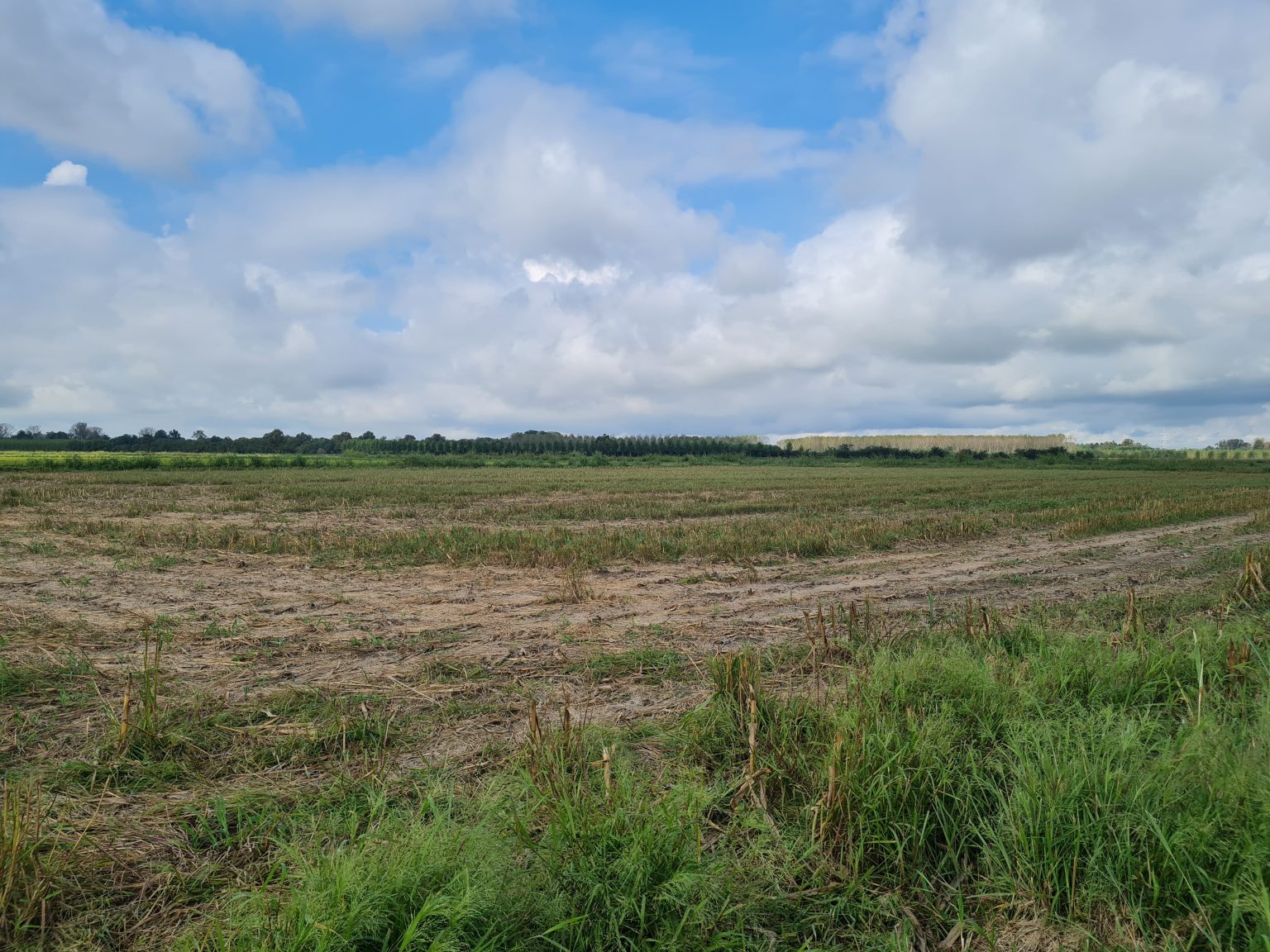
Existing agricultural landscape.
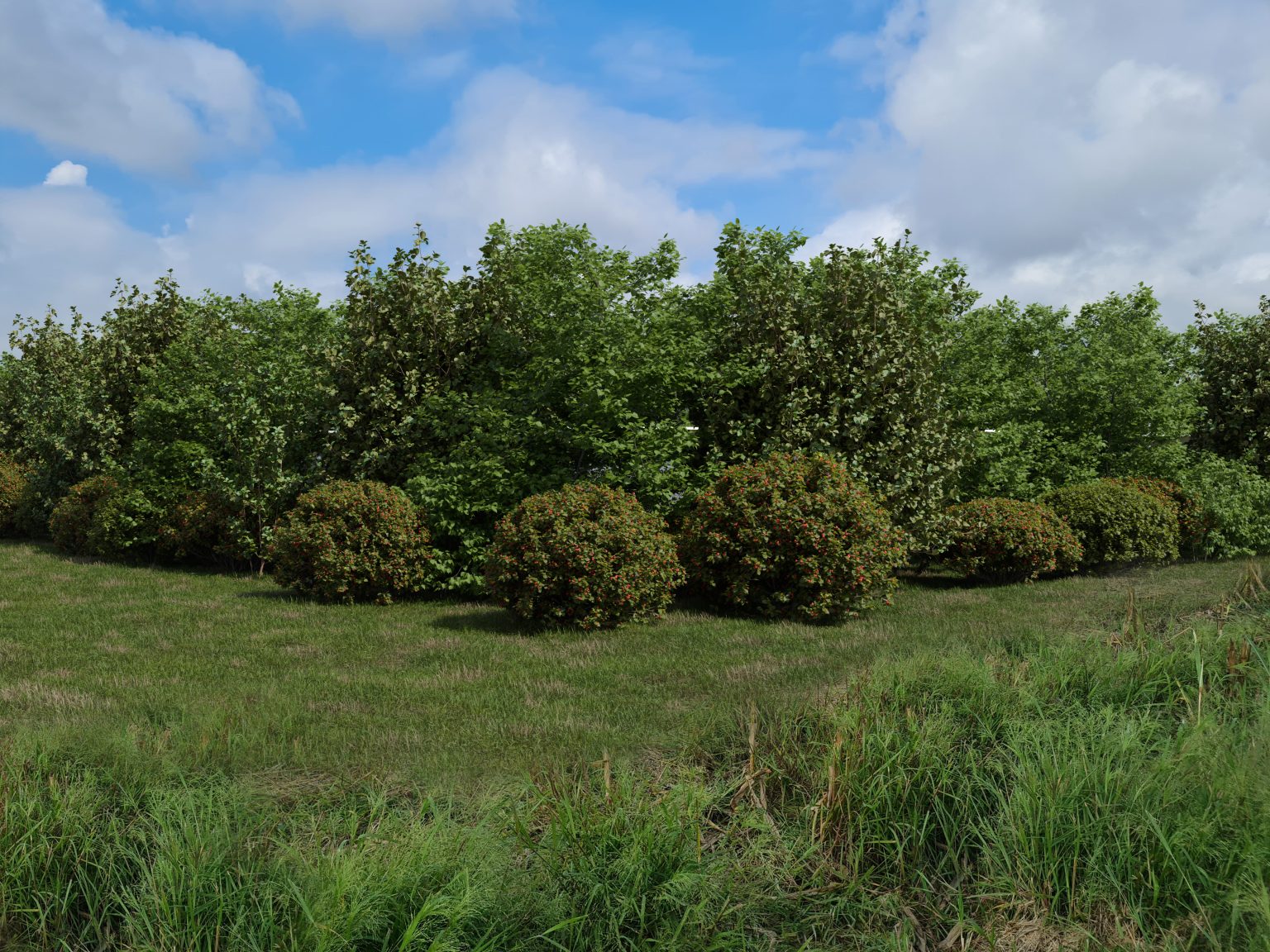
Vegetation screening the photovoltaic installation.
2. Showing Environmental Impact Over Time with 3D Visualization
Unlike static images, 3D visualization for renewable energy projects makes it possible to explore how a site changes under different conditions.
For this photovoltaic project, renders were created to show:
Autumn and winter seasonal conditions
Nighttime appearance
The site at Year 0, immediately after vegetation planting
These visualizations allow renewable energy projects to be evaluated not only at completion, but also during early and transitional phases.
Existing landscape conditions
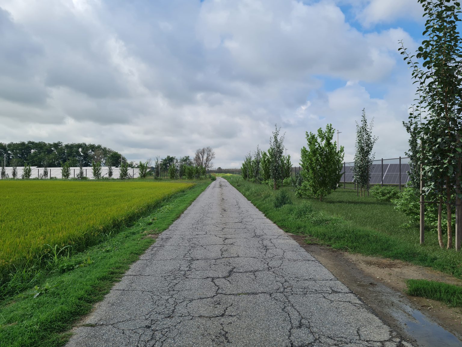
Site condition immediately after vegetation planting.
Photovoltaic installation during autumn and winter conditions.
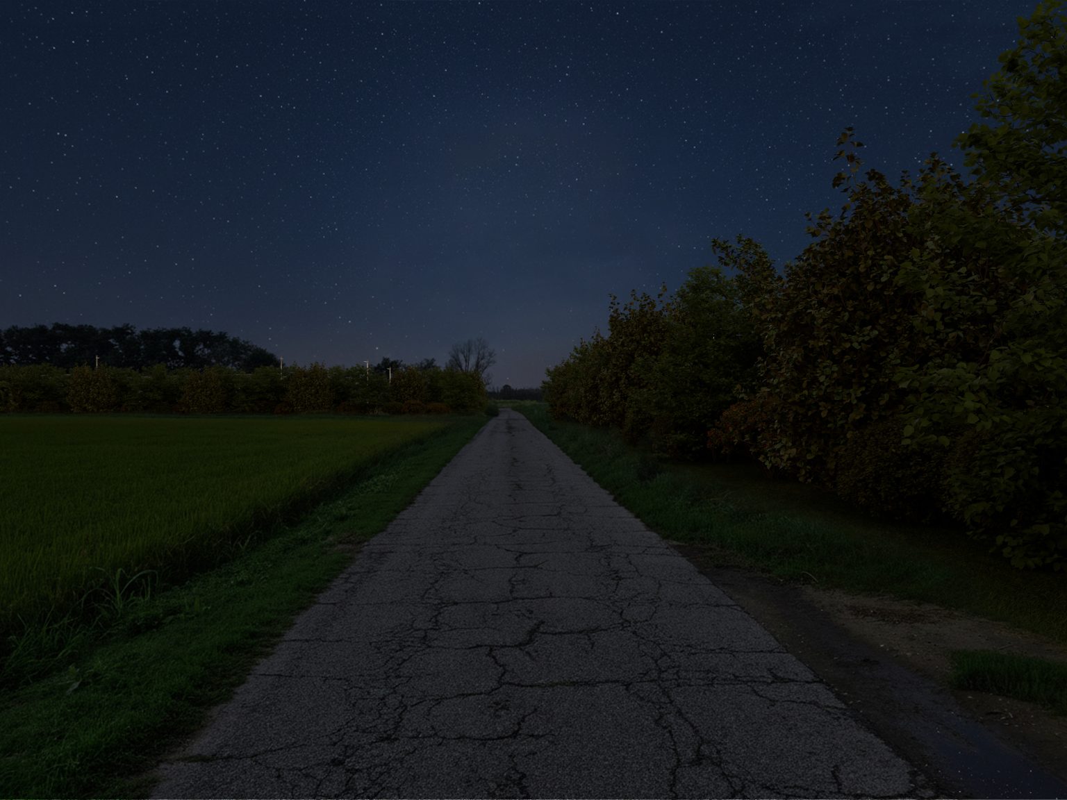
Night visualization showing lighting and visual impact.
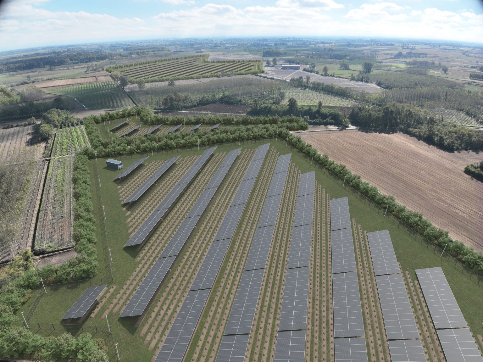
3. Explaining Scale and Layout with Aerial 3D Rendering and Drone Imagery
Large photovoltaic installations require a clear understanding of scale, orientation, and land use.
By combining drone photography with aerial 3D rendering, we transformed an existing aerial image into a clear visualization of the full photovoltaic layout. From above, stakeholders can easily understand panel spacing, orientation, access paths, and how the installation fits within the surrounding agricultural land.
Drone view of the site before development.
Aerial 3D render showing layout, scale, and land integration.
3D rendering for photovoltaic and renewable energy projects is more than a visual enhancement—it is a communication tool. Clear, realistic visuals help reduce misunderstandings, speed up planning approvals, and create transparency between developers, authorities, and local communities.
As renewable energy projects continue to grow in scale and complexity, 3D visualization is becoming a key asset in infrastructure and land-use planning.
If you’re working on infrastructure, energy, or land-use projects and need clearer visuals, feel free to reach out.